Throughout the course of history,
humans have constantly migrated across the great expanses of the earth to
establish diverse communities. From mere wandering packs, some have grown into large
cities harboring millions of individuals while others have chosen to remain in tiny groups totally cut off
from the rest of the world. Some of
these communities have withstood the test of time in their near isolation in their
near isolation state that in extreme cases almost all of their residents have
never seen an inch of land outside the closed hamlet where they call home.
Tristan da cunha
Discovered by Tristanda
Cunha in 1506 who named the place after himself,
Tristan da Cunha is widely regarded as the most remotely populated island in
the world. It proudly boasts of zero restaurants, zero hotels, zero credit
cards and to top it all it has no safe beach. Now who in his/her right senses
would venture to inhabit in such a place?
The Tristan da Cunha made up of
both the archipelago and the main island
is a group of islands in the middle of
the Atlantic Ocean lies 2800
kilometers from South Africa and 3000
kilometers from South America. The nearest land mass to Tristan is Saint Elena
which itself is 2400 kilometers from the island. The Island is completely
surrounded by unsafe waters.
Even though the first official mapping of the
island was made by the French Frigate La
Gorda Bursch in 1767, the first true inhabitant of Tristan da
Cunha arrived in 1810 when American explorer
Jonathan Lambert landed on the island
and and immediately proclaimed himself as its grand ruler (ruler over
nobody per se!).
Presently, Tristan da Cunha is thriving with a population of about 266 individuals.
Unlike most isolated communities, the inhabitants have access to some major amenities including a hospital
that even offers dental services and operating theaters as well as a grocery store. However, orders must be made
weeks or in some cases, months in advance
for grocery items as everything must be shipped to the island. Though modernity has taken over, the remoteness of the island
still makes habitation extremely difficult as electricity is not available
anywhere on the island rather diesel
generators are centrally located between cottages. No wonder why it is called
the introvert’s paradise.
It is noteworthy though to add
that the Tristan da Cunha sits on a very active volcano that erupted as
recently as in the 1960s. So, it may not be such a paradise after all.
Palmerston Island
Discovered by shipwrecked Captain
Cook in 1774, this island sits at approximately 3,250 kilometers northeast of
New Zealand. Palmerston Island is
occupied by just 62 people who strangely,
are all from the same bloodline and holds the record as one of the most
isolated community on the face of the planet.
The inhabitants of the island can
be traced back to just one man named
William Marsters who took up permanent residency there with his Polynesian
wife and her two cousins after being granted
possession of the island by the Great Queen
Victoria in 1863. William immediately took his wife's cousins as his second and
third and together, they had 23 children before his death in 1899. Presently,
all but three of the people on
the island are direct descendants of Marsters.
Life on the island is one of
total isolation and obscurity. There are
no banks, schools, hotels or markets.
Money is only used when trading off the
island or when ships come with supplies from
the outside world. The
remoteness of this island is so precarious that there is no true water system
or even decent toilets. Rainwater is collected for drinking and there are only two public toilets
available for general use. Electricity is only available for six hours
every day and just one telephone station serves the whole island.
Vacation on the Island is not
easy either because apart from the unavailability of any hotel, Palmerston is
about five hundred kilometers
miles from its closest neighbor-
the capital island of Rarotonga and as such, it will take two
days sailing on Pacific Seas boats to reach this castle
of isolation.
Supai village, Arizona
The Grand Canyon is widely
regarded as one of the most widely
revered tourist’s spot in the world because
of its
various jaw-breaking views; but more unbelievable is the fact
that most people do not know that right at the side-branch of this popular
destination lies a very secluded village called Supai.
Supai is located in a side-branch of the Grand Canyon known as Havasu Canyon. The community
consists of members of the Havasupai tribe who have inhabited the
place for the past eight centuries! In total isolation!!
The Havasupai people (mostly referred to as
the people of the blue-green waters) thrive in this arid and
harsh landscape by practicing irrigation farming in the summer as well as group-hunting wild animals during the
winter season. The blue waterfall (one
of the great highlight of the Grand Canyon) does not provide the Supai
villagers with just their namesake but also their water source for survival.
Funny enough, the land in which the
Havasupai live is a well-guarded world heritage reservation.
Civilization in Supai village is
so little that the residents are the
only people in the United States who still receive their mails and parcels by mule-Yes, by an animal. In
fact, any mail leaving there also bears a postmark that is unique to
Supai.
There are not tarred roads nor
vehicular movement, so to reach this village, tourists would have to venture by
foot, mule or helicopter and that its self would mean travelling for about 57
kilometers from the hub of the Grand Canyon.
Utqiaġvik, Alaska
Formerly known as Barrow in
Alaska, lying well above the Arctic is this very remote and cold town called Utqiaġvik.
It is the northernmost city in America and the
ninth most northern city in the world.
Although the weather is extreme,
archaeological evidence
indicates that people have been thriving in this region from
as early as 500 AD. Even though the native Inupiat tribe call the
place Utqiagvik (the place where owls are hunted), after exploration by
Frederick Beachy, the region was named after Sir John Barrow - A
prominent British promoter of Arctic explorations.
The city is built upon a layer
of permafrost that goes down to 420 meters, 1,290 feet deep in some places.
The warm season in Utqiaġvik
lasts a mere three months with
average penultimate temperatures measuring
around 2 degrees Celsius. Next is the beast-The Great Cold Season which
can last for up to 6 months with throbbing peak temperatures ranging around
minus sixteen degrees Celsius.
As if the murderous cold is not
sufficient, the rather shy habitants of this city also have to deal with annual
polar nights normally starting in November.
During this time, the Sun sets in Utqiaġvik and does not rise again for
roughly days. This notwithstanding, the area boasts of a population of roughly
4,433 with Piatt Eskimos consisting of over 65% of this population.
As can be predicted, huge petroleum deposits which
can be found in this region came with its own benefits as their homes are
heated by natural gas from local oil fields and they also have modern water and
sewer systems installed all aver the city. The city has seven churches, hotels,
various standardized schools and good telecommunication network (including
internet!!)
Irrespective of all this
privileges, natives still take part in their seasonal whaling and seal hunting to
“help them wade” the long hard winters and as you can guess, they never leave
their community-even with the well exposed oil workers.
La Rinconada, Peru
Right in the Peruvian Andes, 64
kilometers north off the shores of Lake Titicaca lies the filthy town of
La Rinconada. It holds the record as the highest altitude `in which human
habitation has ever been recorded.
La Rinconada sits at a mind
blowing height of 5000 kilometers–right at the top of Mount Ananya.
Sub-zero temperatures are
generally experienced for most of the year (which is consistent with a region
at this altitude). As if extreme temperatures are not strenuous enough, the
high attitude comes with characteristic altitude sickness including headaches, nausea, shortness of breath and even
death in extreme cases. Beyond the
isolated locale and freezing temperatures, this town has no basic modern
amenities, almost no infrastructure, and no single sanitation system.
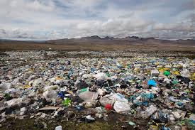
Environmental sanitation is non-existent (most people bury their trash outside of town
or in most cases, simply leave it where it falls).

The ridiculousness and shear
unlivability of the city does not stop
there; as people living and working in
La Rinconada also face demeaning
conditions when coming in and out of the
city as the only roads leading
into La Rinconada are as dirty as
the city itself and iced over for most
days of the year. Don’t worry; I can guess the inkling question on your mind-
why would an individual of sound mental health decide to make such a dumpsite
and death zone a home? The answer is not very far-fetched, it’s Gold. Yes, lots
of Gold.
In 2000, It was rumored that
areas around La Rinconada was lying on tons and tons of gold. Within the next
nine years, the population of the area more than quadrupled with illegal gold mines
and shanties springing up irrationally and irresponsibly.
Presently,
approximately 50,000 people call this squalid city home. Good riddance for such
dirt and squalor.
If you enjoyed reading, do not fail to leave a comment in the comment box below.
Picture Credits
Don Mammoser/Alamy
Telegraph.co.uk
Adventuresportnetwork.com
TheSpruce.com
Pjibest.wordpress.com
guidetoiceland.com
uspsblog.com
Thepaleodiet.com


